Skip to content
STEADYMILE
Shop

Planned peer walks · Nova Scotia, Canada

Nobody walks a mile alone here.

Peer walks in Nova Scotia, Canada are planned future events. The routes below are ideas for those walks. Dates, times and meeting details are still to be confirmed.

  1. 01

    In planning

    Peer walks in Nova Scotia, Canada are planned future events.

  2. 02

    Dates to come

    Dates and times have not been confirmed.

  3. 03

    Details to come

    Meeting details will be confirmed before any walk takes place.

Planned future events

Three route ideas

Ideas for future Steady Mile peer walks. No events are scheduled yet; dates and meeting details are to be confirmed.

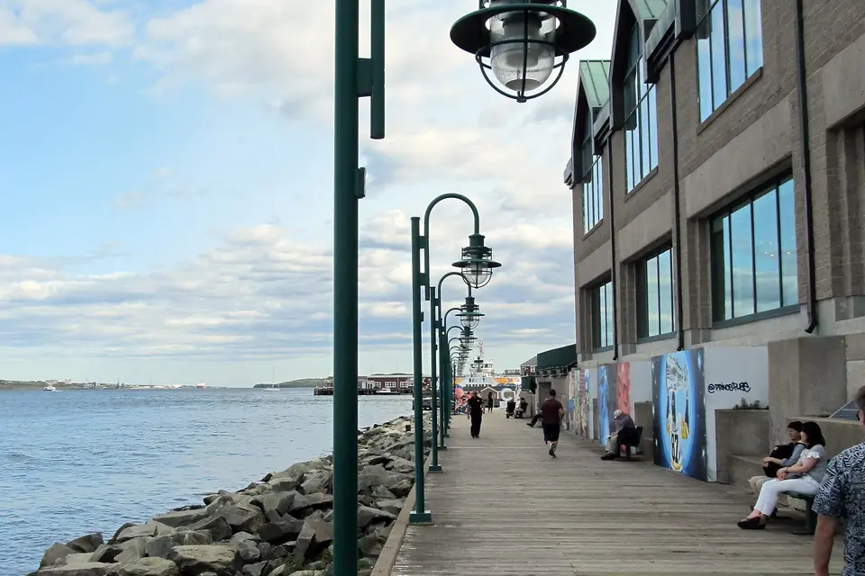
  • Wooden boardwalk with green lamp posts beside Halifax Harbour
    Photo: daryl_mitchell · CC BY-SA 2.0

    Harbour loop

    Halifax waterfront boardwalk

    When
    Date and time to be confirmed
    Meet
    Meeting details to be confirmed
    Distance
    2.7 km loop · About 35 min
    Surface
    Flat — boardwalk planks out, Water Street sidewalks back
    Best season
    Year-round; busiest on the boardwalk June to September

    Why walk it: The harbour on your shoulder the whole way, ferries crossing, and fog most weeks.

    A waterfront route idea for a future peer walk.
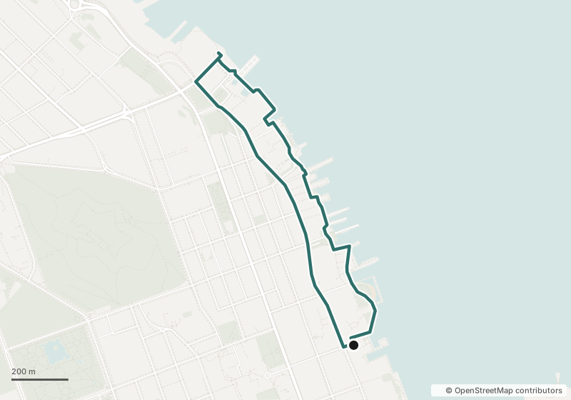
    Map of the Harbour loop along the Halifax waterfront, starting at Bishop's Landing
    Map data © OpenStreetMap contributors
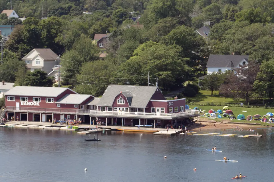
  • Banook Canoe Club boathouse on Lake Banook with paddlers on the water
    Photo: WayeMason · CC BY-SA 4.0

    Lake circuit

    Dartmouth, Lake Banook

    When
    Date and time to be confirmed
    Meet
    Meeting details to be confirmed
    Distance
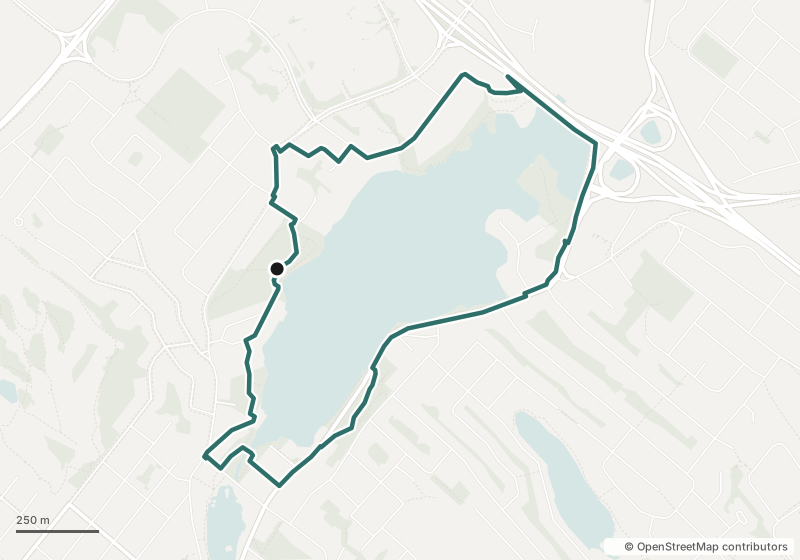
    4.4 km loop · About 55 min
    Surface
    Mostly flat — paved paths and quiet sidewalks, a couple of short rises
    Best season
    Spring to fall, when the paddling clubs are on the water

    Why walk it: Canoe clubs, racing lanes and geese — the lake is busy even when the path is quiet.

    Paddlers on the water, geese on the path. Bring the hoodie after September.

    Map of the Lake circuit around Lake Banook in Dartmouth, starting at Birch Cove
    Map data © OpenStreetMap contributors
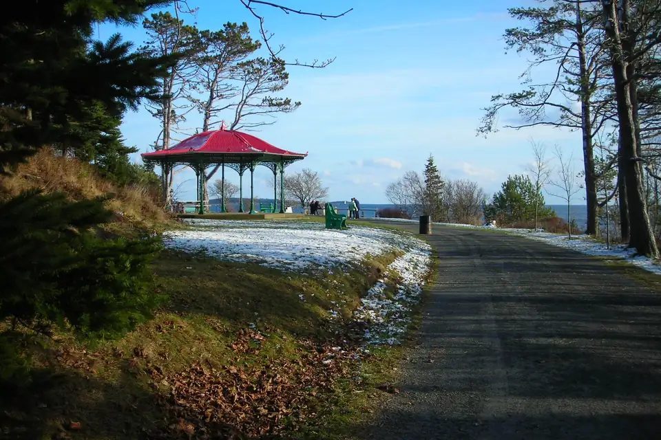
  • Red-roofed pavilion beside a wide path in Point Pleasant Park
    Photo: KMW2700 · CC BY-SA 2.0

    Point Pleasant edges

    Point Pleasant Park

    When
    Date and time to be confirmed
    Meet
    Meeting details to be confirmed
    Distance
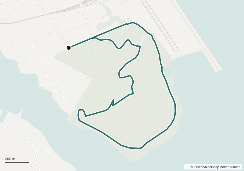
    4.5 km loop · About 60 min
    Surface
    Gentle hills — wide gravel shore road, packed trail through the spruce
    Best season
    Year-round; paths can be icy after a freeze

    Why walk it: The harbour mouth, the Northwest Arm and a spruce trail in one loop.

    The long one. Shore path out, spruce trail back.

    Map of the Point Pleasant edges loop: shore path out from Tower Road gate, park trails back
    Map data © OpenStreetMap contributors

No events are scheduled yet. Please wait for confirmed dates and meeting details before making plans to attend. Maps show route ideas, not confirmed meeting points.

Further afield · Canada

Away from home

Not hosted walks — routes we'd point a friend to. Facts from the park or city that runs each one.

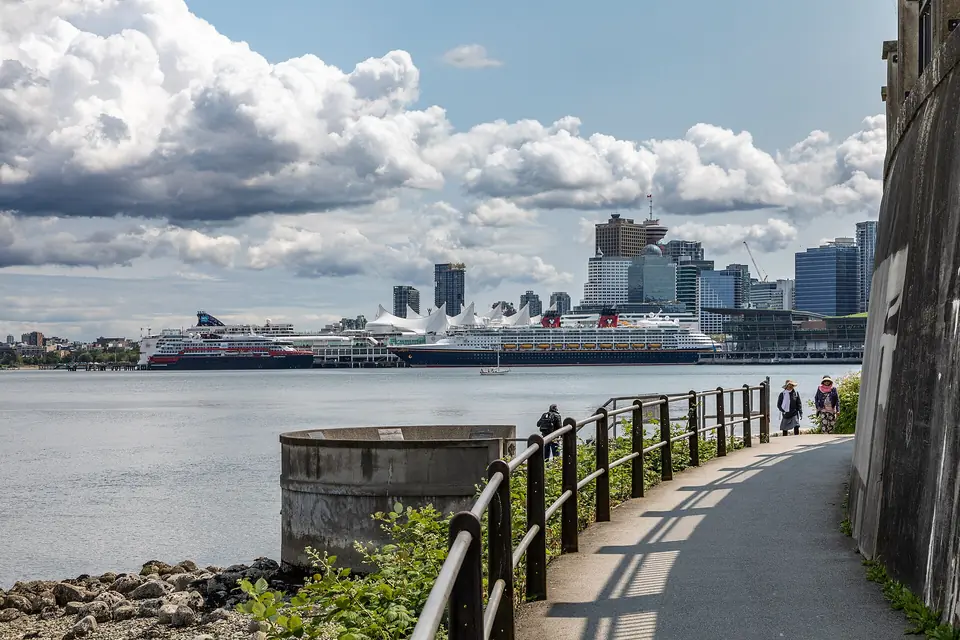
  • Stanley Park Seawall path with the Vancouver skyline across Coal Harbour
    Photo: Dietmar Rabich · CC BY-SA 4.0

    Stanley Park Seawall

    Vancouver, BC

    Around Stanley Park

    Distance
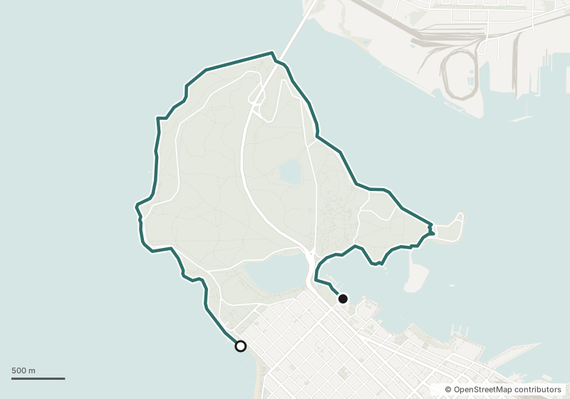
    9 km, Coal Harbour to English Bay
    Time
    2–3 hours
    Surface
    Flat and paved, with a walking lane separate from bikes
    Best season
    Year-round; driest May to September
    Start & parking
    Kilometre 0 at Coal Harbour, by the park entrance off West Georgia Street. Pay parking in lots around the park.

    Mountains, harbour and open water on one flat path around the park.

    Map of the Stanley Park Seawall from Coal Harbour around the park to English Bay
    Map data © OpenStreetMap contributors
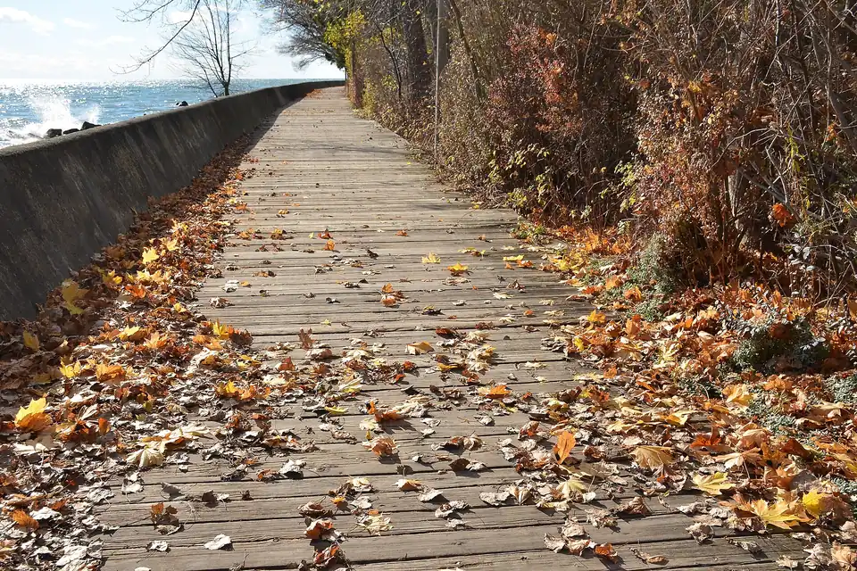
  • Wooden boardwalk covered in autumn leaves along Lake Ontario on Toronto Island
    Photo: shankar s. · CC BY 2.0

    Toronto Island boardwalk

    Toronto, ON

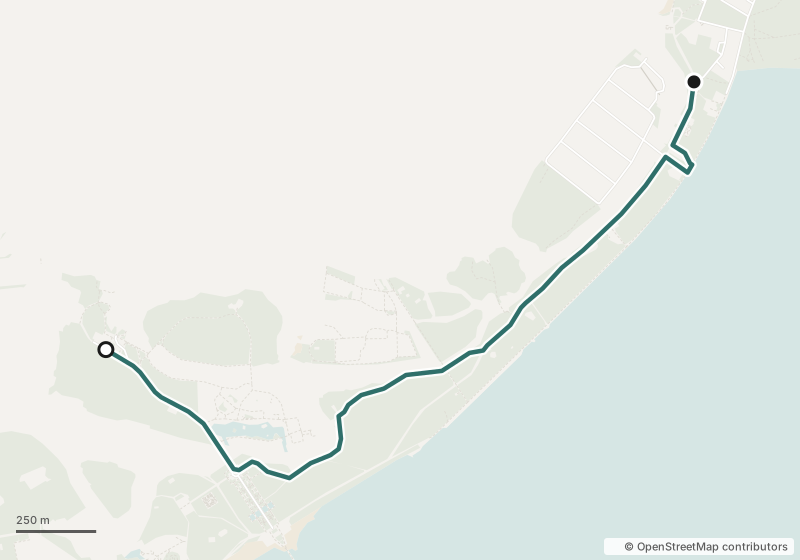
    Ward's Island to Centre Island

    Distance
    2.9 km one way
    Time
    About 35 min
    Surface
    Flat — about 1.5 km of lakeside boardwalk, then paved island paths. No cars on the island.
    Best season
    Late spring to early fall; the island runs colder October to April
    Start & parking
    Ferry from Jack Layton Ferry Terminal (foot of Bay Street) to Ward's Island; ride back from Centre Island.

    Lake Ontario on one side, island cottages on the other, and the skyline from the ferry.

    Map of the Toronto Island walk from the Ward's Island dock along the boardwalk to Centre Island
    Map data © OpenStreetMap contributors
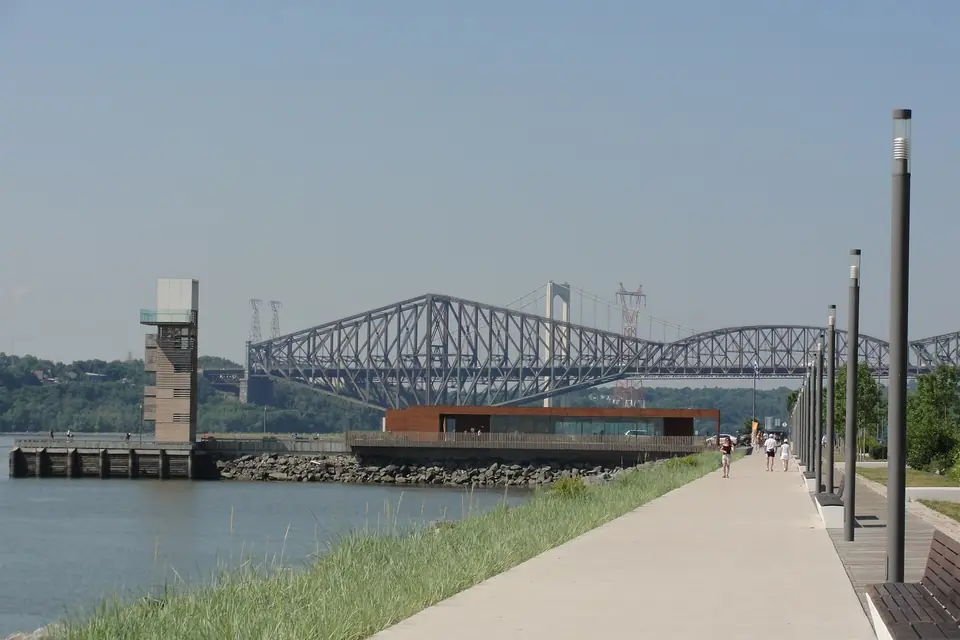
  • Riverside promenade with the Quai des Cageux tower and the Québec Bridge in the distance
    Photo: René Bélanger · CC0 1.0

    Promenade Samuel-De Champlain

    Québec City, QC

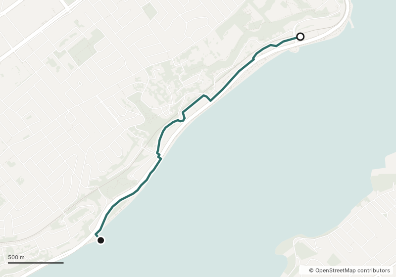
    Quai des Cageux to côte de Sillery, on the St. Lawrence

    Distance
    2.5 km one way (the full promenade runs about 6.8 km)
    Time
    About 40 min one way at an easy pace
    Surface
    Flat, paved riverside paths with a separate bike path
    Best season
    May to October; the observation tower is open year-round
    Start & parking
    Station des Cageux, 2795 boulevard Champlain — 112 parking spaces (no parking midnight–6 a.m.). Leashed dogs welcome.

    Wide-open St. Lawrence views, the Québec Bridge upriver and gardens built where the timber wharves stood.

    Map of the Promenade Samuel-De Champlain from Quai des Cageux to côte de Sillery along the St. Lawrence
    Map data © OpenStreetMap contributors
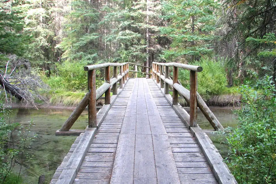
  • Wooden footbridge leading into spruce forest on the Fenland Trail in Banff
    Photo: Yoshio Kohara · CC BY 3.0

    Fenland Loop

    Banff, AB

    Banff National Park, edge of town

    Distance
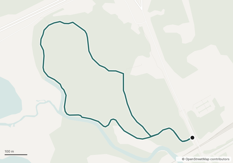
    1.9 km loop
    Time
    About 40 min
    Surface
    Forest path — mostly packed soil with root patches; about 20 m of climb
    Best season
    Late spring to fall
    Start & parking
    Fenland Trail parking area just west of Mount Norquay Road (limited spaces), or walk 1.5 km (about 20 min) from downtown Banff.

    Old-growth spruce and quiet creekside forest, minutes from town.

    Map of the Fenland Loop trail near the town of Banff
    Map data © OpenStreetMap contributors

Further-afield routes aren't hosted walks — check the linked park or city page before you go.

“Consistency over time will get you to the end of the path.”

Phil Asplin · Founder · Nova Scotia
Phil's road

Resources

If today is heavier than a walk can carry, Talk Suicide Canada is there any hour: 1-833-456-4566 or text 45645 (4 p.m.–midnight ET).